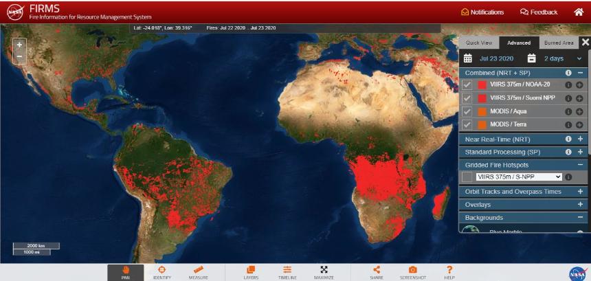
1. NASA GLOBAL FIRE MAP - MODIS SATELLITE IN REAL TIME
Fire Information for Resource Management System (FIRMS)
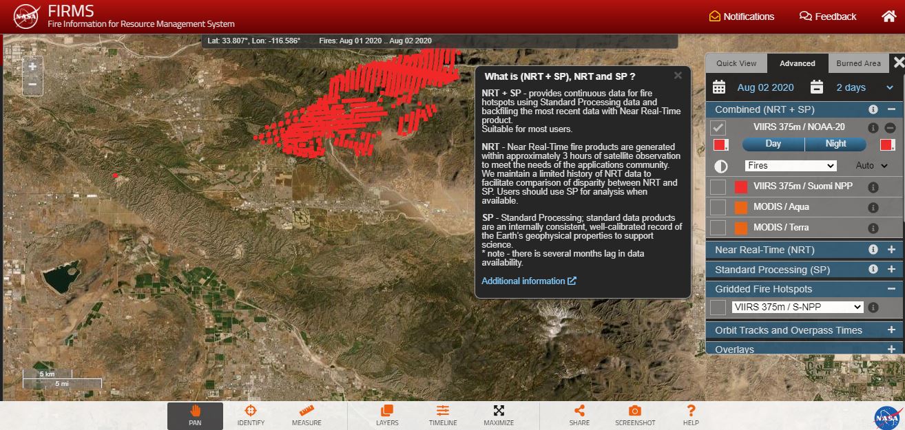
NASA's Fire Information for Resource Management System (FIRMS) distributes Near Real-Time (NRT) active fire data within 3 hours of satellite observation from NASA's Moderate Resolution Imaging Spectroradiometer (MODIS) and NASA's Visible Infrared Imaging Radiometer Suite (VIIRS).
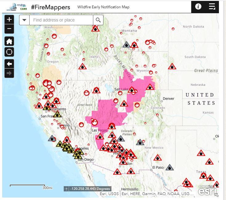
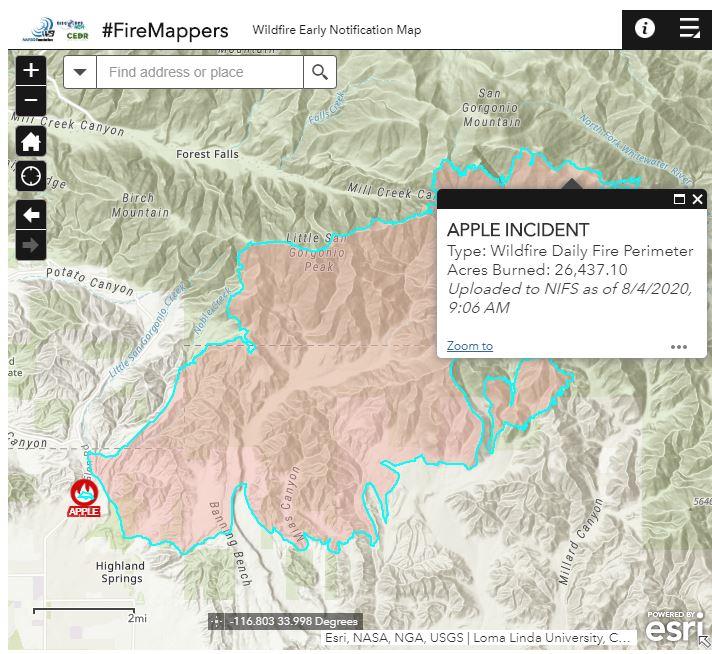
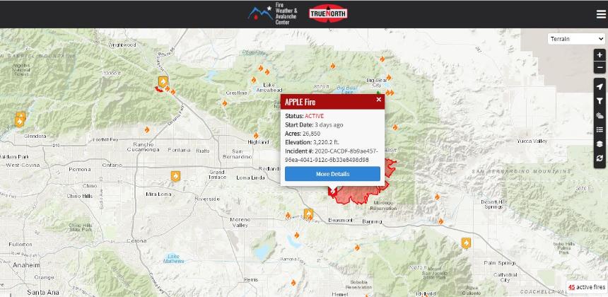
California Wildfire Map - 3 Current Wildfires, Forest Fires, and Lightning Strikes in California | Fire, Weather
& \Avalanche Center
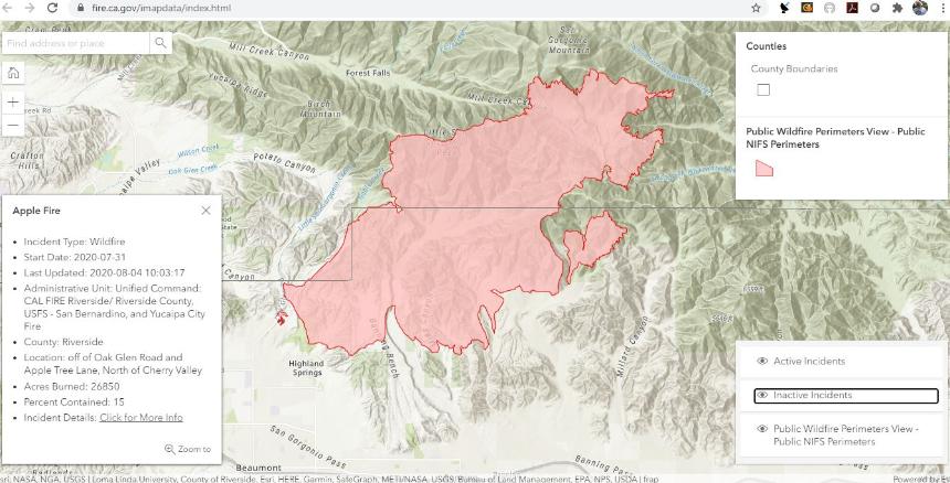
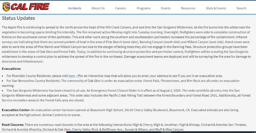
CALFIRE STATUS UPDATES = 4 STATEWIDE FIRE MAPS
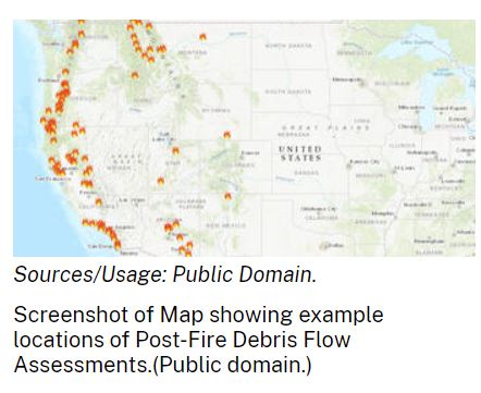
DEBRIS FLOW RISK MAPS IN THE AFTERMATH OF FOREST FIRES
5.Emergency Assessment of Post-Fire Debris-Flow Hazards
By USGS Landslide Hazards
June 23, 2018
OVERVIEW
Estimates of the probability and volume of debris flows that may be produced by a storm in a recently burned area, using a model with characteristics related to basin shape, burn severity, soil properties, and rainfall.
Wildfire can significantly alter the hydrologic response of a watershed to the extent that even modest rainstorms can produce dangerous flash floods and debris flows. The USGS conducts post-fire debris-flow hazard assessments for select fires in the Western U.S. We use geospatial data related to basin morphometry, burn severity, soil properties, and rainfall characteristics to estimate the probability and volume of debris flows that may occur in response to a design storm.
The maps depict the likelihood and potential volume of debris flows as they exit the mountain front in response to a design storm having a 15-minute peak rainfall intensity of 24 mm/h. The models are designed to assess the potential for debris flow in the locations where debris flows initiate (i.e., where they form and get larger).